
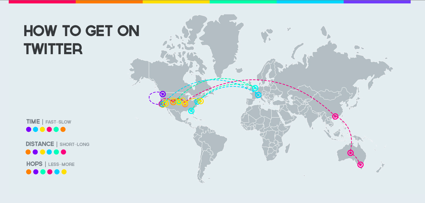
Twitter and Instagram are the social medias people always and always use, so this week I asked my friends who live in different place help me to collect their all router path to get Twitter and Instagram. And I'd like to know how's the physical Intnet path It would be.
At first I ask them use yougetsignal.com to collect their Traceroute and send me the screenshot and the info they get from the site.
I asked 5 friends-->
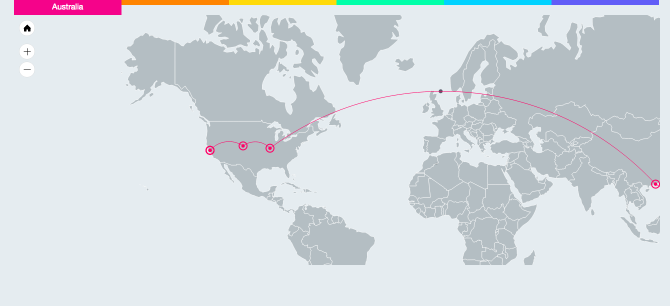
Alice from Australia

Tianxiao from France

Sabrina from Pittsburgh

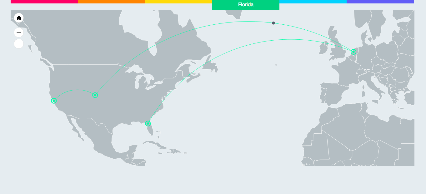
Matt from Florida

Cicillia from Seattle

Include myself from NewYork

At first I'm so surprised all the lines are very different, even though they are going to the same target. And then I save all the infos they get to a JSON file, and use IP TRACKER and IP LOCATION to find each IP address's physical location. Then I show this data on the map with amMap's help to see their physical way directly.
I compared their times of HOPS, times to get the target website, and the distance to get the target website. I found usually long distance means long time, but some times also need to consider you intnet's speed. And at first, I think more Hops means long distance and long time, but I totally wrong, someone with high hops value got on the target website so quickly, I think maybe mane hops also means high communication quality in you website.